Providing fully coordinated, clash-free BIM models, advanced GIS and surveying solutions, and expert training to empower the next generation of BIM professionals
Geo-Portal is a multidisciplinary consultancy specializing in GIS, digital systems, and Building Information Modeling (BIM) solutions. We deliver integrated spatial data, coordinated digital models, and intelligent systems that support planning, design, and implementation across the full project lifecycle.
Our services enable informed decision-making, efficient coordination, and seamless integration from early concept through execution.
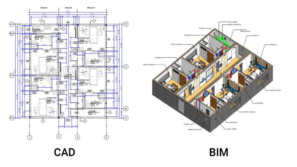
Transform your 2D CAD files into precise, data-rich BIM models for better coordination, visualization, and project efficiency.
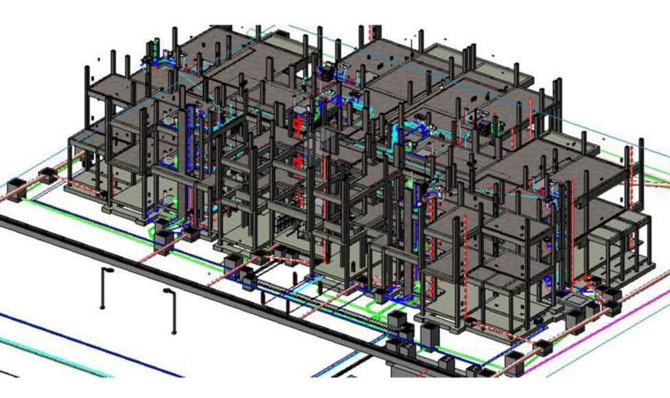
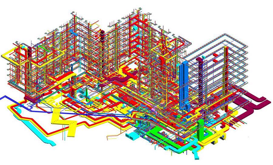
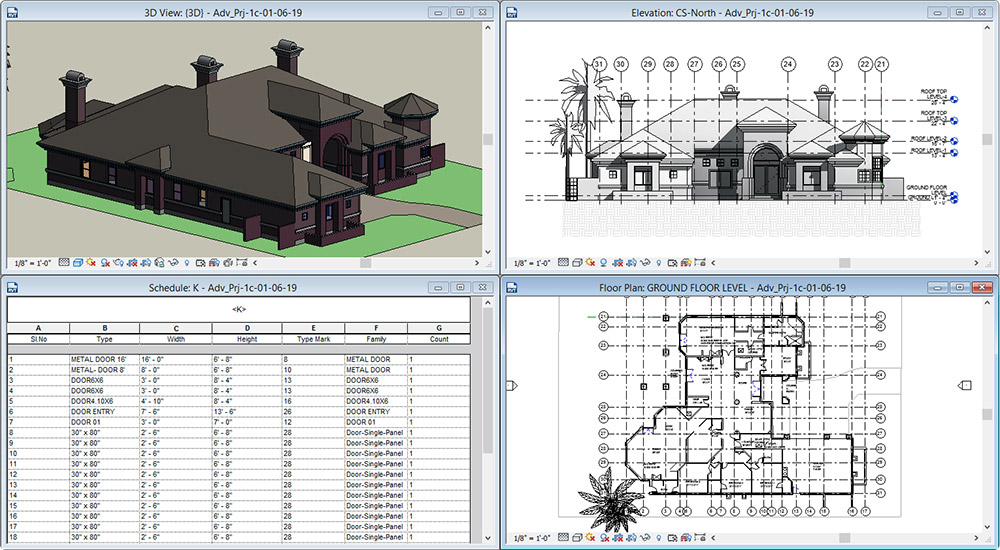
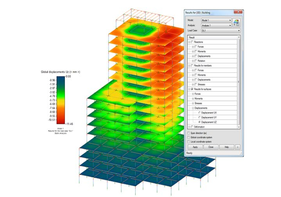
We deliver fully coordinated, clash-free BIM models across all disciplines, with precision up to LOD 500. Our models ensure seamless integration, reduce on-site errors, and support every stage from design to facility management.
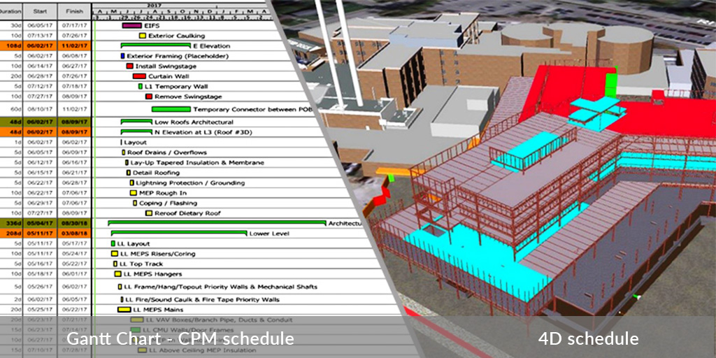
We integrate time (schedule) with the 3D BIM model to create detailed 4D simulations, allowing teams to visualize construction sequences, detect timeline clashes, and optimize project planning before execution.
We link accurate quantity takeoffs from BIM models with real-time cost data to deliver precise 5D simulations. This enhances budgeting, cost control, and decision-making throughout the project lifecycle.
We provide 6D BIM models that support sustainability and energy performance analysis. Our models help assess environmental impact, optimize building performance, and support green certification goals—delivering smarter, more efficient designs.
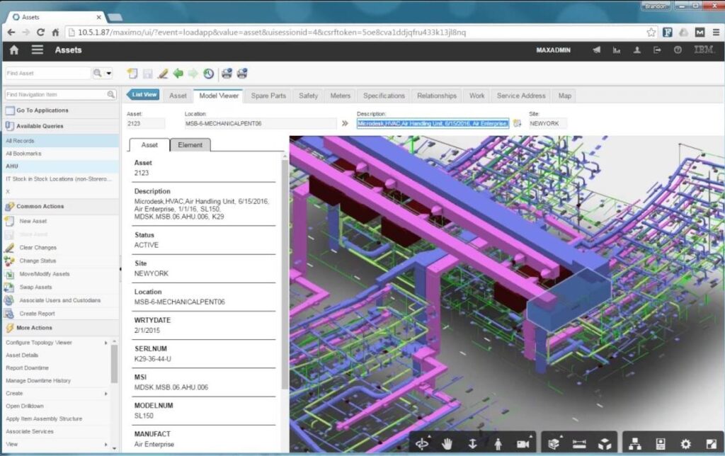
We deliver data-rich 7D BIM models designed for seamless integration with facility management systems such as IBM Maximo. Our models include structured COBie data to support efficient asset tracking, maintenance planning, and long-term operational performance.
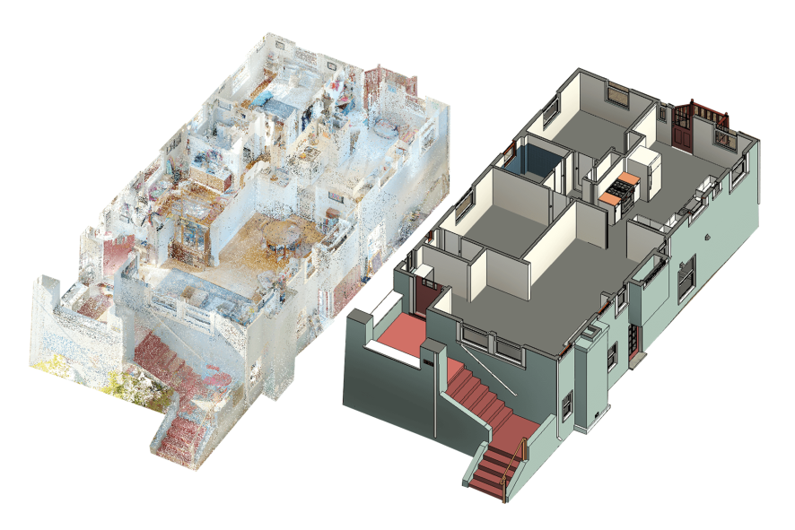
We transform 3D laser scan data into accurate Revit models using Autodesk ReCap and advanced modeling workflows. This service ensures precise as-built documentation, ideal for renovation, facility analysis, and project verification.
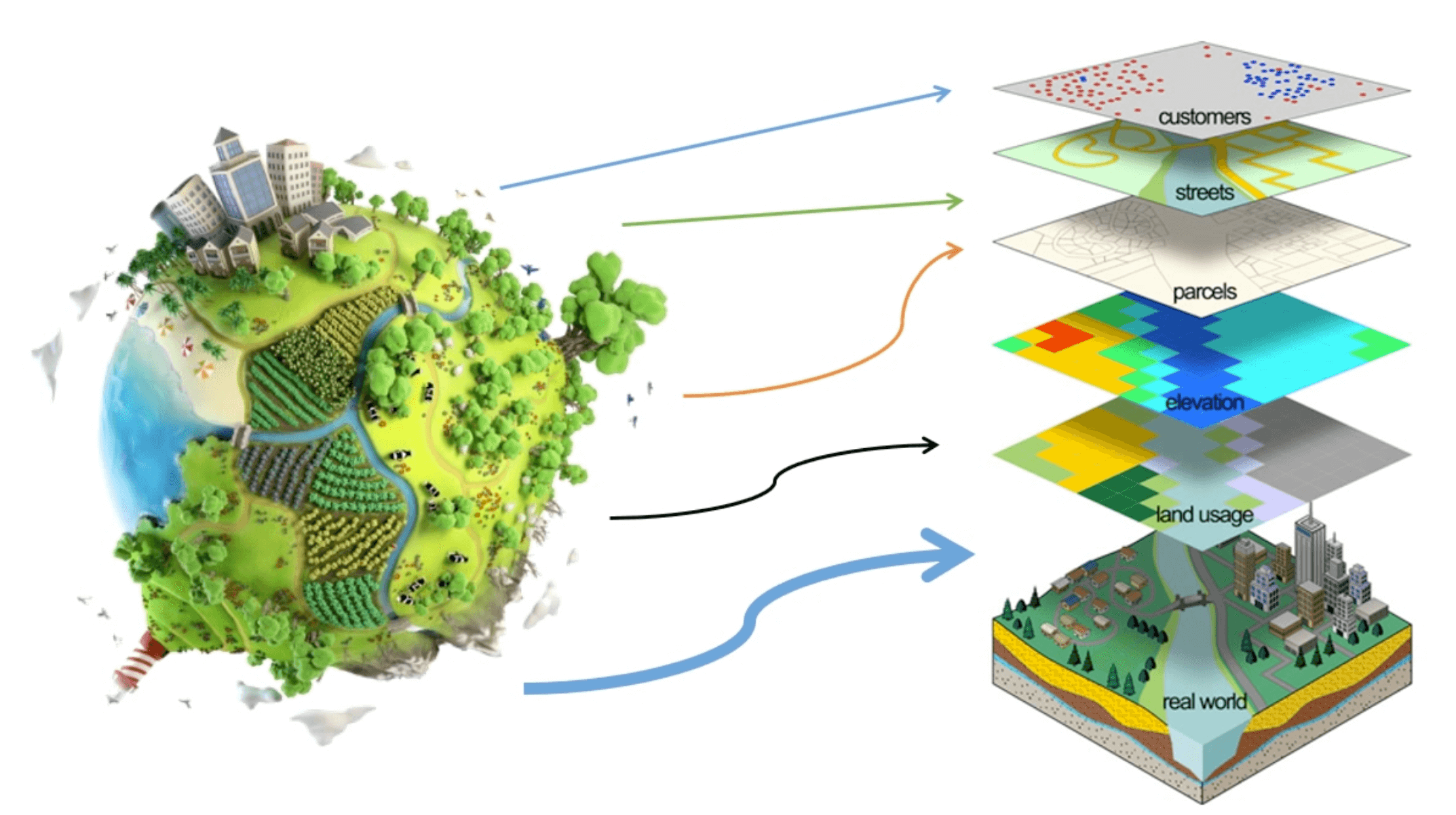
We deliver advanced GIS solutions that transform spatial data into actionable insights with exceptional accuracy and clarity. Our services combine precise geospatial analysis with intuitive visualization, making them perfect for planning, decision making and infrastructure management.
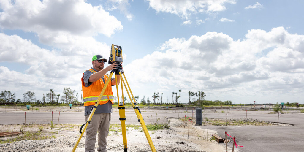
We provide professional surveying services that capture every measurement with unmatched precision and reliability. Our work delivers accurate, dependable data that forms the foundation for successful planning, design and construction.
We create high-end interior and exterior renders that capture every detail with precision and realism. Our visuals combine architectural accuracy with artistic quality ideal for client presentations, marketing, and design validation.

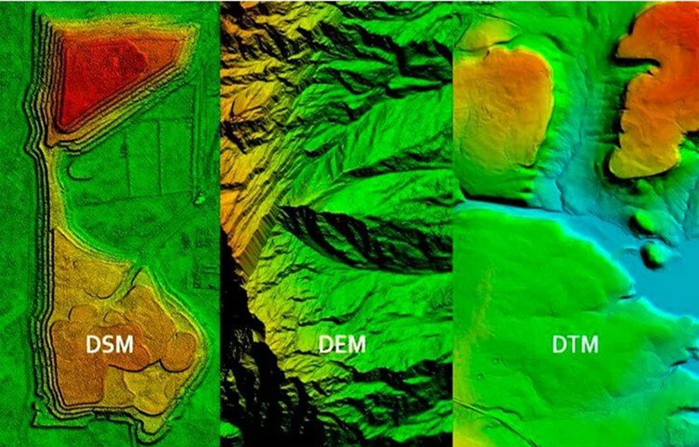
We specialize in extracting high-quality Digital Elevation Models that capture terrain details with exceptional accuracy. Our DEMs provide reliable elevation data essential for analysis, planning and informed decision making.
We provide hands-on BIM training for individuals and corporate teams, covering tools like Revit, Navisworks, and complete BIM workflows. Our programs are designed around real project applications and include an internationally recognized certificate issued by accredited U.S. universities, ensuring both practical skills and global credibility.


Geo-Portal provides GIS, digital systems, and BIM services, supporting data-driven planning, design, and implementation. We deliver integrated spatial data, coordinated digital models, and reliable technical solutions that enable smarter, faster project execution.
B7, Maadi Gardens Compound, El Mokattam, Cairo, Egypt
Info@Geo-Portals.com
+20 100 1551742
© 2025 Geo Portal. All rights reserved.